Thursday, August 29, 2013

Murphy is a tease

29 August

We had rain last night and it is a 30% chance of rain all day today.  It looks like it could rain any time, just gray and dreary.  Maybe because we haven't had much recent experience with rain, we decided not to risk bike riding, because the roads were already wet and the man at the campground's office told me the distances were longer than you'd think on the map.  In other words the map wasn't drawn to scale.  Instead we opted to lock our bikes to the picnic table and head to "downtown" Kennebunkport.  It is a quaint tourist New England town, that has an art gallery on every corner.  I did find several stained or fused glass ideas.  Roger and I are still dumbfounded by the price of "art," but I really liked the windvanes.


After strolling through both Kennebunkport and Kennebunk, we drove two scenic routes.  The first is referred as "Walker's" Loop, which has the Bush compound.  I learned from the man in the campground's office that the Bush's have been vacationing in Kennebunkport for generations.  That "41's" father was a US Senator from Connecticut and that the family has been summering for as long as local folks can remember.  There are countless articles in various shops that say "the  Bush family buys ____ here."

The second drive we took was down to Wells, and we spent an hour walking on the beach.  It was not a sunny or warm beach day, but it was nice to get some exercise.  We were gone for 4 hours and it did not rain.  Murphy is probably laughing at us, because if we had gone out bike riding Roger is sure that it would have rained on us at the farthest point out.

We had originally planned on driving Long Island, but I pointed out to Roger that this is "Labor Day Weekend."  Therefore we won't be on Long Island.  We both studied the map between here and Reid and came to the conclusion there isn't much we haven't recently or already seen.  Fortunately I was able to contact one of my Colombian cousins, who now lives in New Brunswick NJ, so that's where we're going tomorrow.  Adriana and Eduardo just moved from Champlain IL to New Brunswick, so it is really great that we have some place to go as far as having a destination.
 

Wednesday, August 28, 2013

On the road again

Finally the part came in and the RV's turbo is now repaired.  We left Bangor around 11ish and headed south.  First stop, Freeport ME, home of LL Bean.  Once we found the right LL Bean store, I was able to exchange my ear pinching sunglasses and we were headed south again.  We drove through some interesting afternoon fog, where it was warm enough to cause the cold water to fog.  From there we headed to Kennebunkport ME.  Our plans are to spend two nights and do some bike riding tomorrow, if the weather cooperates.  Hopefully it will rain tonight and get it out of it's system so we can get into the town of Kennebunkport and down to the beach.  We have a bike route, with only a short stretch of bothersome road.  I'll let you know tomorrow. 

Tuesday, August 27, 2013

No joy

27 August

Our part for the turbo is a wayward part.  It was supposed to be delivered early this morning, but things didn't go according to plans.  The delivery service truck broke down.  Don't know why they don't use their own trucks, but the truck broke down.  We were originally told that the dealership didn't have the phone number for the driver.  So when the dealership called the delivery service after 1 pm, we were told that the part would not be delivered today.  Roger and I even volunteered to go where the truck had broken down, but the dealership was not told where the parts truck was being serviced.  Rather mysterious to us.  We were also told that the head honcho in charge of the service department could not allow us to go get the part ourselves.  So instead we spent the day waiting, being told different things (not by the dealership, but by the delivery service), and did a little bike riding. 

Bangor is not a bike friendly town, so we were told the safest place to ride our bikes was the cemetery, which was nearby.  So we rode around the cemetery, which was established in 1836, so there were some rather interesting grave markers.  There's also a section dedicated to the Civil War veterans of the 2nd ME Infantry, which were the crucial Infantry group that held their ground at Gettysburg.  Roger could give you more details on this, just ask.

The folks are complaining here that it is hot!  86 degrees, but we do have our air conditioner running since we have a dark gray RV.  It's a very random partly cloudy day.  If we had known that it was going to be an entire day waiting for a part, we would have gone back to Acadia.  There's another couple who is also having RV issues, but we're lucky because our campground is only about 20 minutes away and they've committed to a campsite well over an hour away at Acadia, because they wanted to have a site for Labor Day Weekend.

Keep your fingers crossed for us to have better luck tomorrow.

Monday, August 26, 2013

Quirk Dodge


26 August
Quirk Dodge determined that the RV needs a part that will be coming from Boston tomorrow, so by 10:30 we were headed to Bar Harbor and Acadia National Park.  First stop was up to Cadillac Mountain, which is the highest point on the US Atlantic seaboard, and is the first place you can see sunshine in the USA due to its elevation of 1,528 feet.  It would have been great to see the view, but we were up in the clouds and couldn’t see much at all.  Typical for us.  (As an aside, it was sunny in Town Hall when we left, but as we headed towards the road to Cadillac, it clouded up again.)  After going up the mountain to see what we could see, we drove the park loop.  The NP has made the majority of the loop one way, which is really nice because the single two way lanes are now one lane with passing lanes and easy pull outs.  Plus the road has been recently paved.  Since we got a really late start, parking for hiking was a challenge, so we might make the 45 minute tomorrow if the repair doesn’t take too long.


After the park we went down to Bar Harbor and walked the town.  The town is quaint and touristy.  From there we went to Atlantic Brewery, which is a micro-brewery that had a tour and sampling.  We also had an early supper there.

Who knows what will happen with the clock and RV tomorrow.

Sunday, August 25, 2013

Relaxed Sunday

25 August

We made it to Bangor.  Now that we're here I can write about why we cut our stay short in Canada.  While on Newfoundland the turbo on the RV's engine started giving us problems.  Initially the problem was a very annoying high pitched whine.  The turbo is needed to climb hills by kicking in only when needed to boost the engine's power.  Without it, we poke up hills and not with any safe speed.  Well the turbo stopped working for a while and we limped to Bauline East.  Roger was able to find out on line that occasionally the turbo will reset when the engine gets cool.  Fortunately that was the case for us.  However not knowing when it would fail completely we decided to take the ferry soonest off Newfoundland.  Once we got back to Nova Scotia we started calling Mercedes/Dodge dealerships trying to find a Sprinter tech.  The earliest we could get an appointment was this coming Friday, the Friday before a long weekend.  So we decided to head towards the USA and see if we could find a dealership that could get us in sooner.  Tomorrow we have an 8:30 am appointment at a Bangor ME dealership.   The good news is that the turbo only stopped working one other time, so we got lucky.  We're camped for the night at a place about 10 miles from the dealership, so we'll be able to make it there with or without the turbo.  Hopefully the dealership will have the part to fix it and we'll be back on the road again.

Needless to say, Roger hasn't slept soundly because his toy has been acting up.  This will all be history soon.

We did get to take a nice bike ride today.  The weather was "lovely" today, 75 degrees and not a cloud in the sky.  Same weather forecast for tomorrow. Sleeping tonight without the a/c again, although we did switch blankets because it's not supposed to get as chilly tonight.

Leaving Canada


24 August

We left Harve Bouchre NS, and headed west on TCH 104.  Because the road was either 3 or 4 lane divided highway we made good time and opted to take the Fundy scenic drive, so at Moncton New Brunswick we headed south on 114.  The Bay of Fundy has a tidal range of 46 feet and is suppose to be the largest tidal range in the world.  There’s a park at Hopewell Rocks that we stopped at and saw the mouth of the Petitcodiac River meet the Bay of Fundy.  The Petitcodiac River is called the “Chocolate River” because the silt in the water has so much iron oxide in it, and the tidal range is so strong and quick that the silt never really settles enabling the river to run clear.  The Bay is milk chocolate brown at Hopewell Rocks.  When we got there the tide was already coming in, so the beach was going to close in less than 15 minutes or rambling down by any of the formations.  Therefore Roger and I opted not to make the 10 minute scramble down the beach only to have 5 minutes on the red beach.  Instead I’ll just include pictures of the Flower Pots which are rock formations with trees on that that become islands at high tide, tidal arches a favorite kayak spot at high tide and the Daniel Flats.


At Alma, which is the entrance to Fundy National Park, the Bay had a brown streak in it as it mixes bay water with Petitcodiac water.  Then by the time the Bay is geographically by Saint John and its river, the Bay is a pretty blue green.  (Note Saint John in New Brunswick is not to be confused with St. John’s in Newfoundland.)
 
We made it to Bayside on the north bound part of Route 127.  We got a little turned around in St. Andrews, because south 127 ends and we didn’t see the sign for north 127 until we turned around at the end of the road in St. Andrews.  Bayside is across one of the arms of the Passamaquoddy Bay from Maine.  The Passamaquoddy empties into the Bay of Fundy.  Tomorrow we’ll drive to St Stephens and cross into the USA at Calais Maine.

Friday, August 23, 2013

Newfoundland to Nova Scotia


22 August

We had to check out of the campground well before we had to check into the ferry, so we drove the 5km back to Placentia and took advantage of their wifi for the price of my coffee.  We chatted with a couple who were camping in the back of their extended bed pickup truck.  They were from Prince Edward Island and had come over to Newfoundland for two weeks.  They were intrigued as to what we thought of PEI.  Afterwards we headed up to Castle Hill, which was another French fortification that the British got control of once the French were defeated in the 1750s.  It is a National Historical Site (NHS)with only a little refurbishment. 


The ferry left at 17:05 and since we had changed our reservations we ended up having a 4 bunk room, even though there were just the two of us.  We had a so so all you can eat buffet dinner, contrary to what you read on line, it was not gourmet.  Neither Roger nor I slept well.  Roger thinks because the beds were not “fore and aft” so when there was rolling it just felt off to his retired Navy brain.  I just didn’t sleep well because my “salty dog” was snoring louder than usual, despite being in a separate bed. 


23 August

The ferry had a relatively calm transit, despite a lot of wind.  We were off the ferry by 10:30 and headed to Fort Louisburg.
Fort Louisburg is a reconstructed French fort.  It is based on a lot of archeological digging and research.  It is another NHS.   The fort’s construction started in 1720 and was basically completed 10 years later, although buildings continued to be added after the town of Louisburg grew.  The French Army was completely reliant on imports from France, unlike the soldiers in Lake Champlain NY who had to fend for themselves and make their own shoes, clothes etc.  There were several demonstrations throughout the fort, very similar to Jamestown VA.  There was a lady who was making lace, a skill that she had learned from a French neighbor.  It was taking her one hour to make half an inch of lace.  She was acting like she was the lady of the house, who had time to do such activities and servants to do the daily chores of house keeping.  The lady women at the Fort were very genteel and did not have the typical frontier woman’s life once a governor was sent to Fort Louisburg.  The town continued to grow after the French left, and the mainstay of commerce was cod fishing.  Back then an average cod weighed 25 lbs, was salted and dried down to two pounds and shipped back to France.  The fish was then reconstituted to almost 25 pounds with the addition of water.  It was very interesting listening to the guy who was acting like a fisherman.


We are now in Antigonish NS.  Tomorrow we should be spending the night in St John New Brunswick, and back in the USA on Sunday in Bangor Maine. 

Thursday, August 22, 2013

Argentia

21 August

We left Bauline East and headed to Argentia.  Argentia is where we'll take the Ferry back to North Sydney Nova Scotia.  The Ferry is an overnight and takes 14 hours.  There will be no internet so this will have to do until sometime Saturday night.  The campground at Argentia is at an old US Navy base that closed in the 70s.  The view was nice, but it is really windy.  Yesterday was cold, 55, but today it's already 66.  There was no internet at the campground, right now we're at Philip's Café with coffee and Wifi.  We walked the boardwalk at Placentia, which is the town next to Argentia.  Argentia is actually the harbor (thanks to the USN) and Placentia is the town where folks live.  At the campground we did some walking around, but still haven't found our moose.


I had a conversation with a Newfie, who works at the campground.
Newfie:  How's r ya?
Me:  Fine sir.
Newfie:  Ya likin our area?
Me:  Yes sir, but we.
 still haven't seen a moose.
Newfie:  Why there was one slipped down last night down that way.
Me:  Was it hurt?
Newfie:  Whatcha mean?
Me:  Was it hurt when it slipped down?
Newfie:  Don't think so, why'd'ja ask?
Me:  Well you said it slipped down.
Newfie:  So
Me:  How'd you know it slipped down?
Newfie:  Why I saw it.
Me:  Did it look hurt?
Newfie:  No, she was bedded for the night.
Me:  Resting from her slip?
Newfie:  No, she was bedded for the night.
Me:  I don't understand Newfie.
Newfie:  Oh, slipped down doesn't mean the cow slipped.  It means she's cozied down in a spot for the night.  Moose sleep curled up on the ground at night.
Me:  Thank goodness the moose wasn't hurt.
Newfie:  Hope you find your moose.
Me:  Me too.


Tuesday, August 20, 2013

St John's and Bell Island


20 August

St John’s Newfoundland is the windiest, wettest, foggiest, snowiest major Canadian city.  Don’t ask me what constitutes a “major city”, since St John’s population is 101,000 people.  Regardless, after a pleasant afternoon yesterday, a front came in last night and today was a cold (for August) dreary day with a high of 55.  We tried to go to The Rooms, but it didn’t open until 10.  So instead we decided to go up Signal Hill where Guglielmo Marconi received the first transatlantic wireless signal in December 1901.  What was extremely interesting to us was the fact that Marconi used a kite with 150ft of wire as his antenna and that he was unaware of the use of the ionosphere to bounce radio signals in the frequency that he was receiving.  The use of the ionosphere was not understood and defined scientifically until 1923.  In other words, Marconi was lucky.


Since the day was such an indoors day, we also went to the Johnson Geo Centre.  This is an earth/space science center and considering the size of St John’s was well done.  We watched a 3D movie on the Monarch butterfly’s migration and the historical discovery that it takes three generations to migrate from Mexico to Canada, but only one super Monarch to make the return trip.  We had also seen a special on National Geographic channel reporting on the same things, but the fact that this one Canadian couple did research for 40 years (although tagging was only over 20 years) and happened to come across a labeled butterfly that was tagged in Toronto in Mexico made the film fascinating.  The couple used supermarket price tags to tag butterflies and citizen scientists to report to them the tag numbers and location.  Citizen scientists also wrote to report if they found any tagged butterflies.  This started in the 1960s and I think the discovery of the Mexico site was in the late 70s early 80s.  The Centre also has a section dedicated to the Titanic.  We caught a short talk about the mistakes made by the Titantic, including not having enough lifeboats, not having the radio room manned 24/7, and the resulting changes implemented by the cruise lines as a result of the accident.  Each person going through that section of the Centre received a piece of paper with a name and history.  I got Mrs Anna Hogeboom, age 51, from NYC, who was traveling in first class and returning from travelling in France and Italy since November 1911.  She survived.  Roger got Svend Jenson, age 19, from Odense Denmark, who was traveling in third class and going to meet family in Oregon who had already emigrated.  His family were farmers who were going to the USA for better opportunities.  He did not survive.  60% of people traveling in first class survived, only 25% of those traveling in third class survived.
After we left Signal Hill we decided to go to take a ferry to Bell Island and tour the Bell Island Mine #2.  The ferry ride was rather choppy due to the wind, but at least it wasn't dreary.
 
Bell Island Mine #2 was an iron mine that operated from 1902 until the mid 60s.  Ed was our tour guide and he really enjoyed talking about the mine as his father was a miner.  The miners worked in teams of two and had a daily shift quota of 20 carts, with each cart holding a little less than a ton.  The miners shoveled the iron and horses brought the carts back to the mouth of the mine.  As the mine got deeper, stables were built for the horses, who could spend up to three months underground.  They would start deep and work their way back up to the mouth.  When their rotation was up, before they left the mine they were blindfolded to protect their eyes.  The horses spent a month in the pastures before entering the mine again.  A good horse could last 20 years in the mines and then they were retired to permanent green pasture.  The men worked 10 hour daily shifts, Monday- Saturday and started working around age 10.  The job the men did depended upon their age, skill level and time in the mine.  The mine went deep and underneath the seabed of Conception Bay.   After the tour we headed back to the ferry and landed back on Newfoundland Island.  From Portugal Cove we drove back by St Johns and headed south to Bauline East and a campground on the Atlantic. 
 

Tomorrow we’ll head to Argentia, which is where we’ll ride the ferry back to Nova Scotia on Thursday evening/Friday morning (14 hours trip.)

Monday, August 19, 2013

Same thing, different day


19 August

Not much to write about today, more of the same and nothing picture worthy.  We left Deer Lake and headed east along TCH to St John’s.  Our thoughts were if we saw something interesting we’d stop.  We had made a couple of stops at quilt/craft/local artisan places when we headed north, but I’ve given up on finding something worth buying.  I guess the diehard shopaholics will still buy hand knitted things, but when you can knit even those items have lost their appeal.
The road between Deer Lake and St. John’s has a couple of high-tech "Moose near road flashing lights", which were triggered but we didn’t see any moose.  Roger did have a moose sighting.  Unfortunately it was a small moose that was road kill.  I didn’t see it as I had glanced down to do a Mary Ellen, and was looking at the map.

We’re pretty close to being as far east as you can get in North America.  Tomorrow we’ll be going “downtown” to see what St John’s (population 101,000 and capital of the Province) has to offer from a tourist perspective.  I hope to get a decent picture of Jelly Bean Row among other things.  Keep on reading to find out.
Canada has 10 provinces and 3 territories.  We've been to 9 of the 10 provinces, plus the Yukon Territory.

Sunday, August 18, 2013

Is it a fen or a bog?


18 August 
Last night in north New Foundland we were at a campground that instructed you to boil water for 5 minutes before drinking, yet we had our best Internet connection of the trip to date.  In fact we were fortunate to FaceTime with Trent, which was great catching up with him.  He would have reached 100 surgeries on Friday, but two were canceled.  Regardless he is feeling comfortable with “routine surgeries” and hopes that his supervisors think he’s ready for more challenging assignments.
Now back to the trip…
We drove south (because we were as far north as we could get) along 430 and the St Lawrence Bay to Gros Morne National Park.  It took us 4 hours to get to the park, which was good.  We took a 6km walk out to Western Brook Pond, through bogs and sub artic forest (thinks squat short pine needle trees), with some late season flowers.  Of course we didn’t see any moose, but lot of other folks were headed out the walk to take and  the two hour boat tour out to the former fjords that were carved by glaciers.  As ice bit through the 1.2 billion year old block of granite and gneiss, fjords were formed as was Western Brooke Pond.  We could have hiked further, but it required fording Brooke Creek and there’s no way I’m deliberately getting my feet wet hiking, without the proper equipment. 
 

After our stroll, we headed south again for another trailhead.  Unfortunately it took us a lot longer than we thought it was going to take, so we opted just to pull out at a scenic view of the eastern arm of Bonne Bay and the Tablelands. 
 
 It was getting late, and Roger didn’t want to drive on unfamiliar roads with potholes, narrow shoulders, and possible wandering moose (if the prolific signs were any indication; however they were probably all napping when we went out to Woody Point.)  We got to out campsite with no fuss and are spending the night at Deer Lake, which is at the junction of The Canadian Highway 1 (TCH1) and 430.  All in all a lucky day-- because we only saw a short drizzle of rain.

Random thought for the day—why don’t groceries sell beer, yet gas stations do?  There are frequent signs about hands free cell phone usage, but beer is sold at gas stations (along with hunting licenses.)

The answer to the title question is a fen is the same thing as a bog.

Saturday, August 17, 2013

Norsemen and not Vikings


17 August
Roger wanted to go to L’Anse aux Meadows, which is as far north as you can drive in Newfoundland and “only” 700 km from where we started this morning.  The tour book says it should take 12 ½ hours from Port Aux Basques (the ferry landing) and we were about an hour north of there.  I was not looking forward to an 11+ hour day.  I guess the tour book expects travelers to stop along the way, because fortunately for me it only took 8 hours.  Whew!  Despite light annoying rain for about a third of the way, we got to the National Park around 4 pm and had enough time to see the Norse camp and model building structures.  I learned today that Norsemen were the peaceful explores and temporary settlers around 1000 AD.  Vikings are the marauders and fierce warriors intent on wrecking havoc.  So the Norse explorers are believed to be the first Europeans to reach North America via an Atlantic crossing.  Vikings never made it to North America.  The picture of the grass is the actual unexcavated site of various Norse buildings.  The Park Service has build model buildings based on archaeological findings, so visitors can get a better understanding of what the Norse brought to the continent.  We watched a film that told us that the Norsemen traded milk and cloth with Native Americans for their animal skins, and it is speculated that the Native Americans also wanted the Noresmen’s iron tools, which were prized possessions and not available for trade.  The Norsemen came to Vynland in search of iron and tall trees.  Apparently there were trees available for use during that period of time, however today it is speculated that the climate is much colder and more sub-arctic with bogs and very short coniferous trees.  To me this was an interesting take on global climate change.


This bronze monument was interesting, but to get to it you had to tromp through about 5 feet of bog before the trail had dry land.  I used my binocular camera technique to get a picture worth posting.  (Of course Timothy would have used his mega zoom to make the monument feel like it was right next to me.)
Tomorrow we’ll head back south to Gros Morne National Park, which is supposed to have some very good trail hikes.  Hopefully it won’t be raining.

Time check for those who are curious.

8 am in Garden Ridge = 9 am in Louisville = 10:30 am in Newfoundland    The time zone in Newfoundland is one half an hour earlier than the Atlantic time zone.  Yes it is very odd, but we have to be precise with our time so we don’t arrive late to the ferry next Saturday.

Along Canadian 430, which cuts arcoss the top of the island not on the coast, I noticed small plots of fenced land.  When I asked about these plots at the National Park, I was told that these plots are Sovereign land and that the coast families have claimed small plots to garden because the land they own is too rocky along the coast.  The guy at the park said that families have been gardening this way for years, but this may come to an end because “nothing is without a price these days.”  We also saw lots and lots of wood piles in various stages of cutting.  I was told that permits are obtained to cut wood and bring it in to the road for curing, splitting, and eventual transport to homes for heating.  The air must smell like a forest fire in the winter time based on all the wood we saw being seasoned.  There were a couple of places that I noticed 6 or 7 digit signs.  I thought this must be the phone number to call to buy wood.  I was told that the number is the Permit number and that all the wood piles we saw were supposed to be displaying their permit numbers.  I guess only ¼ of the piles had their numbers large enough for me to see from the road as we scooted by.

Newfoundland


16 August  No pictures, because the Atlantic Ocean still looks like an ocean.

From North Sydney to Channel Port Aux Basques.  Today was a hurry up and wait day.   Since we didn’t know how long it was going to take us to get to the ferry landing, we got up and got rolling.  I had researched a bakery, so we figured we’d hit it for some fresh baked goodies before sitting in line to board the ferry.  We got to the bakery at 8:20 and it didn’t open until 9 am.  What kind of bakery doesn’t open until 9?  We left and headed to the line for the ferry.  Roger ended up talking with several people who wanted to know about our RV.  This provided him several repetitive conversations, plus tours, which he didn’t mind.  We were supposed to be in line 2 hours before the scheduled 11:45 departure.  We weren’t the first folks in line, but it did make for a quick exit off  the ferry once we got to P Aux Basques.

The ferry crossing took 6 hours, because we had very good weather.  The ferry was very similar to ferry we rode on between England and Ireland or Ireland and Scotland.  It was not crowded, but we also avoided the children’s play area deck.  We didn’t see any whales, which was disappointing.  We had picked up a brochure from  the campground in North Sydney on a campground about 35km off the boat, so once we landed we high tailed it to the campground.  We were the first of many to make it to the campground off the ferry.   Since ignorance is bliss, we didn’t find out until we got to the campground that there was a serious ferry accident about a week ago involving a ferry in Port Aux.  Apparently this has really messed up outgoing traffic, and the guy I talked to at the campground said he had been waiting for a week to get off island.  He was leaving tomorrow.  Fortunately things are finally settling back to business as usual.  Roger and I did some talking on the ferry (before we knew of the accident) and decided to change our plans and try to leave out of Argentia back to North Sydney.  This is an overnight ferry trip, but requires no back tracking across the province which seems a better fit for our plans.  In the meantime we’ll be in Newfoundland for a week, and headed up north to the ~1000 AD Viking settlement, then work our way back south and east towards Argentia. 

The campground had a very interesting newspaper.  Yesterday on our bog walk we saw some flowers we didn’t know what they were.  The newspaper had an article on the flowers.  “Newfoundland’s provincial flower is the Pitcher Plant.  It is found primarily in bogs and marshlands.  It has a large wine-red flower with a gold center, and hollow pitcher-shaped leaves are attached to the base of the stem.  An insectivorous plant, it feeds off the insects that become trapped inside when the leaves fill with water.  This water is an old fashioned remedy for pinky eye.”

Another interesting article in the paper was:  A little Newfoundland Boy was sitting on a rock with a gallon of turpentine and shaking it up and watching the bubbles.  A little while later a Priest came along and asked the little boy what he had.  The little boy replied, “This is the most powerful liquid in the whole world, it’s called turpentine.”  The priest said, “Oh no my son, the most powerful liquid in the world is Holy Water. If you take some Holy Water and rub it on a pregnant woman’s belly she will have a healthy baby.”  The little boy replied, “If you take some of this here turpentine and rub it on a cat’s behind, he’ll pass a Harley Davidson.”

This is what happens when you read the local newspaper, because there’s no internet or TV.

Thursday, August 15, 2013

Cape Breton


Happy Birthday Vicky!

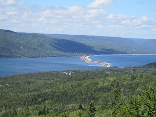
Today we traversed Cape Breton Highlands National Park.  The St Lawrence bay side was cloudy and dreary.  When we got to the Atlantic side the sun finally poked through.   We did two short hikes, and still didn’t see a moose even though we hiked through a bog that is frequented by moose.  The other hike had several nice views, despite the cloudiness of the morning.
 Mushroom (fungus) found on St Lawrence side trail.
 
 St Lawrence side trail
 
St Anne's Bay
We had a short day and are doing RV keeping and associated chores, which means the RV got a much needed bath and our laundry is in the dryer.  The names of a lot of places we passed through have either been French, English or Scottish.  We made a couple of tourist stops along the way, including a very interesting glass artisan shop.   There are lots of Breton artist gallery’s along the Cabot Trail.  Tomorrow we’ll be taking a 7 hour ferry ride over to New Foundland.   In the meantime, we’re enjoying the sunny, breezy afternoon in North Sydney.  It is a hot 74 degrees.  The weather forecast for tomorrow is even hotter, 78 degrees!  We have the windows open and the screen on the door, it is really “quite lovely,” (a nod to our Aussie mates.)  Stay cool our Texas friends and family.

14 August


14 August

A dreary morning in East Prince Edward Island, so we headed to the north central coast to see if it was any better.  Before we got really going we stopped at MacAusland Wool Mill.  Wool fabrication is very much a cottage industry in PEI.  The MacAusland Wool Mill had ancient looking machines that were spinning yarn from big bales of dyed wool.  It was very noisy. The products for sale were all seconds and not very interesting or pretty, socks, hats and blankets of faulty coloring (according to the sign, and I definitely agreed.)  This coast is also the setting for the Anne of Green Gable books.  There were 8 books in the series, which I have not read.  Lucy Maud Montgomery came to live in Cavendish PEI when she was 21 months old to live with her maternal grandmother, after her mother died.  Maud Montgomery wrote the books around the 1900s and died in Toronto Canada in 1942; however she is buried in her favorite place on earth Cavendish.  The coast has red sandstone and Roger kept telling me I was getting too close to edge.  He eventually followed me down to the water’s edge via a series of step downs.  (In other words I didn’t fall like I suspect thought I might.  The water’s edge was in PEI National Park of Canada. 

 
From there we headed towards the bridge, to get back to New Brunswick.  The bridge is a toll bridge headed off island and the cost was $44.50 for a car.  We had looked into the ferry, but had not made a reservation, so the only time we could get over was too late at night, since we like to be camped by 6 at the latest.

We drove to Baddeck Nova Scotia, which amounted to over 600 km.  Roger has a cold, so I even drove for a couple of hours, because he said he was tired.  I think I need to sedate him if he’s not asleep in the passenger seat.  There was a brief period where the GPS got lost and Roger had to regain consciousness to figure out where we were headed.  I was pretty sure I knew that we didn’t need to change roads, which was in fact the case, and GPS finally figured out that we weren’t going the wrong way.

When we pulled into the campground and there were several police cars and a command center.  There is an ongoing search and rescue effort for an 81 year old woman, who was living at the campground with her nephew, has wandered off.  The search has been going on for over 24 hours and from what we were told by the campground staff is the good news is that it isn’t getting too cold at night.  Of course the police and rescue efforts don’t need a bunch of gawkers asking  nosey questions, so this is all we know.  It looks like there are at least 20 people involved in looking, as night approaches.

Wednesday, August 14, 2013

13 Aug


13 Aug  a DiNozzo kind of evening
We did some miles today, as I was lured in by Roger saying that he wanted to get to Prince Edwards Island.   Fortunately for me, I had seen enough of the Quebec coast and once we crossed into New Brunswick, we were on Canadian Highway 2.  The map makes it look like an interstate, when in actuality it is two lanes with frequent passing lanes.  There were also a lot of moose collision warning signs, but we didn’t see one moose, just lots of dead porcupines and skunks.    As I mentioned in Quebec, all the signs were in French with no English.  We expected to see English again in New Brunswick, which we did.  However all the signs we’ve seen so far, in both New Brunswick and Prince Edwards Island, are bi-lingual.  At a gas station in NB, a guy with Maine tags told Roger that we were lucky not to have run into any chip on the shoulder folks in Quebec, because he has experienced the refusal to speak English or acknowledge an understanding of it in Quebec.  I guess having TX tags helped, because apparently there is some animosity between Maine folks and the citizens of Quebec.  Roger and I got to wondering about having to have bi-lingual signs in the southwest USA, only time will tell.

When we got off the 13 km bridge to PEI, we stopped at the information center.  I got the PEI magazine and looked for campgrounds.  The Good Sam book had slim listings, so I figured having a local source would be better.  We’re spending the night at Mill River Provincial Park, which had good ratings.  The campground had its grass cut today, as well as rain earlier in the afternoon.  Roger and I decided we need to take a walk, so off we went.  [I am a NCIS fan, because of the cast and writing not due to the farfetched Navy crimes they investigate.  Gibbs regularly cuffs Di Nozzo on the back of his head, whenever Tony says something stupid.]  Now with this background in mind, picture the two of us strolling along in the campground, when Roger starts smacking my head.  Apparently I was being attacked by mosquitoes and Roger felt obligated to beat some mosquitoes submission and into my hair.  I felt like I was being Di Nozzoed.  Repeatedly!  The mosquitoes weren’t noticeable when we left the RV and I had on a long sleeve shirt.  They left my body alone, and started after my unprotected head.  Of course they weren’t bothering Roger, so there was no reason to Di Nozzo him.  After some objection on my part, Roger started counting how many victims he had saved me from.  Once over 20, I sort of lost my sense of humor.    Needless to say, after inspecting the bath house with my clothes on, we both opted to take our showers in the cozy little shower place in the RV.  The other thing that is lacking in the campground is WiFi.  Oh the withdrawal of being dis-connected!  What will Mom think?  Will she think that I was swept away by a cloud of angry Canadian mosquitoes?  Or that we finally found that elusive wild moose, only to be attacked.  Mom, if you’re reading this, we’re OK.

We’re in for the night and planning our route for tomorrow.  Roger was reading the PEI magazine and would like to share some of the information he read:  “Summer is hot, but rarely very humid.  The daytime temperatures are usually in the 70s, and can go as high as 90.”  In our opinion today was humid, but not hot, 80 degrees.  Tonight we’ll be switching to the lighter blanket and sleeping with the windows open, as usual, no ac required.

In case you’re curious, gas is $1.40/liter which converts to $6.22/gal.  Diesel is $1.35/liter which converts to $6.00/gal.  Fuel prices have varied less than a few pennies per liter, throughout the three provinces we’ve been in so far.  We noticed more variety in western Canada last year.

Monday, August 12, 2013

Gaspesie Peninsula

12 August

We left Cap Chat and headed toward what we thought was a National Park, but found out that Parc National de la Gaspesie is a provincial park (state park) de Quebec.  We walked about 2 miles to the Lake of the Americas.  Along the way we saw fly fishermen, an abandoned beaver dam and lodge.  On the way back there was a grouse with a couple of chicks on the trail path.  The rest of the trails were really long, 10 plus miles and I wasn’t up for it as I had a minor headache (which decided to hang around all day.)

From the park, Roger took the eastern scenic highway along the St Lawrence Seaway and the Gaspesie peninsula.  It was a long scenic day with a variety of coastline mostly with rock shores and cliffs.  I think we passed 3 different lighthouses.  Roger also wanted to drive the coast in Parc National Forillon (which really is a National park), but the paper maps and software maps were not accurate.  There is no road along the coast and it is all back country hiking routes.  I am not a back country hiker.  So we drove as far as we could and then detoured back to the scenic route along the southern coast of the Gaspesie peninsula with a westward heading. 

We made it to Perce for the night and looking at the map, it really doesn’t look like we covered a lot of miles, but with an average of 50kmph you don’t get a lot of kms in a day.  Plus there were several construction places that we had to wait for one lane passage.


It never got above 70 here today.  Last night we had to break out our heavier blanket because it was chilly sleeping.  We have yet to have to use the space heater like we did a couple of times on our western Canada trip last year.  There’s a chance of rain tomorrow, so Roger isn’t looking forward to driving in the rain.  Hopefully we’ll get to New Brunswick and back into the land of the English speaking Canadians.  Signs are confusing in French, but we’ve figured out what the construction signs all mean, based on all the detours and slowdowns we saw today.  The people that we’ve met are friendly enough, but French Canadians remind me of Texans, first claim is to their province/state, then to their country.   Seems silly to me, but I’m still undergoing the “naturalization process.”

Sunday, August 11, 2013

51!


11 August,  Happy Birthday Timothy!

We left Levis, QC and headed northeast along Canadian Hwy 20/132.  Once you get off of 20, highway 132 is a very picturesque drive along the St Lawrence Seaway.  Our first stop was in Rimouski, where there was a lighthouse and Roger toured the Onondaga, which is a retired Canadian diesel submarine.   The lighthouse is listed as "a rare octagonal concrete lighthouse, finished in 1909 and is 108 feet tall."
 
Roger did some NATO work with submarines of the same class as the Conondaga, which was decommed in 1998.  There was a 45 minute self-guided tour that Roger enjoyed, as well as being amused by people trying to figure out how to operate hatches and duck their heads when stepping through the hatches.  Fortunately I had “Gone Girl”, so I was kept occupied reading while Roger was touring.  From Rimouski we continued on 132 Est through the dairy and farmland.  Crops have changed to wheat, soy, and canola, as well as hay for the milkers.  We stopped at a Formagerie du Litorral and bought some local cheese which was $39/kg which converts to $17.72/lb.  I skipped the cheese curd, because I have tried it before and didn’t really care for it plus the small cheese wedge was so pricey.  We stopped at the grocery store as well and walked away with very little to show for our $50. 
We’re spending the night outside of Cap Chat at a campground right on the coast.  It is a windy, sunny 62 degrees.  Surf is definitely up on the St. Lawrence and there’ll be no need for the ac once again.  I would guess we’ve seen over 100 windtricity windmills along 132.
The campground has lobster fest going on right now.  We ordered one pound of lobster that is cooked and can be picked up at a requested time.  The price for one pound was $19.  I had bought corn on the cob, so this evening’s menu is going to be lobster and corn.  I’m sure I’ll be picking it for the both of us, since like chicken; lobster should be easy to eat according to Roger.
 

Saturday, August 10, 2013

Quebec City

10 August Quebec City

We took the ferry from Levis which is a 10 minute ferry ride across the St Lawrence River to Quebec City (QC, not to be confused with the province of Quebec).  We then headed to upper town to the fort of Quebec.  There are three tiers of street stairs and the AAA tourbook says its “170 precipitous steps of the aptly named Breakneck Stairs which have been around since the settlement’s beginning.”  We took a tour of the fort, however the initial fort wasn’t a substantial building until after the British beat the French.  The fort is called the Citadelle, despite being built by the British from 1820-1870.  At QC the St Lawrence River (Seaway) has a bend and dramatically necks down from a wide river to a much narrower defendable choke point.  When Winston Churchill saw QC, he referred to this choke point as the Gibraltar of the West.  Roger and I were both wondering why the people of Quebec still are so staunchly French, since the British beat them and later built the substantial fort to defend Canada from any potential Yankee action.  In fact, the French basically left North America once they were defeated and the remaining French Canadians were left to trap and trade, just like they had been doing since French settlement of Canada, without protection of the French government.  Our guide sort of glossed over the facts and said that the French Canadians were and are a staunchly proud people.  The Citadelle is headquarters to the only French Canadian Regiment in the Canadian Army, the 22nd Regiment.  This Regiment speaks French and does all its official duties and correspondence in French.  The Commander of the Regiment is always French Canadian.  This whole segregated idea seemed very different to Roger and me.  (The Changing of the Guard Ceremony at 10 was canceled today, due to strong winds.  However two guards were posted at the entrance to the Citadelle.)


After we left the fort we strolled through the park and upper city.  The most architecturally interesting building in old QC is the Fairmont “le Chateau Frontenac” Hotel.  The AAA guidebook recommended strolling through the lobby, which we did because its interior is an example of Canadian Railway Architecture and was the meeting place of Canadian leaders, Winston Churchill and President Roosevelt during World War II.  We eventually wound up at the marina where there was an Art Festival.  To me, it looked like a lot of leather, clothes and purses with local labels slapped on the item for re-sale as “art.”  There were several woodcraft items and jewelry for sale that were local art.  I didn’t see anything I had to have.  Roger sat on a bench while I cruised through the tents.

On the way to the ferry pier, we were passed by well over 100 T-Rex cycles.  Apparently there was a rally at the lot right next to the ferry pier.  We had to wait as they drove by, because the police were giving them right of way just to get them out of the lot.


Roger is busy trying to figure out where we are going tomorrow, as we’re headed north and further east.  We have ferry reservations for 16 August from North Sydney, Nova Scotia to Channel-Port Aux Basques, Newfoundland where we will spend a week before returning to the mainland.